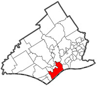
Chesters plan to implement the GeoCAMS crime analysis and mapping system. Police believe that crime in Chester tended to be “concentrated” in specific areas, so if they could identify and target these areas, they might be able to reduce crime.
Chester named their version the Chester Crime Analysis and Mapping System. The program allows officers to enter data, which it turns into maps showing crime patterns and hot spots. This in turn helps officers “develop more informed crime-fighting strategies and tactics” like patrolling hotspots more.
It “allows a user to see what happened as well as where and when a crime took place, enables users to create a tactical deployment plan by drawing on a map and alerting law enforcement personnel close to the scene.” The detective information mapping tool “gives users the opportunity to create a map that records the physical, social, and location-based characteristics of a suspect.”
http://www.gisdevelopment.net/application/casestudy/case002.htm