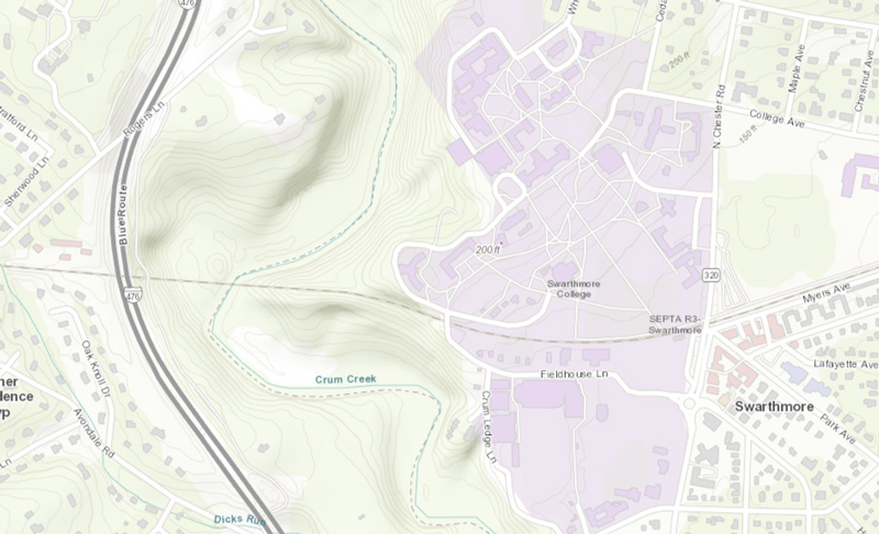
Built initially to host and internally publish data on the underground utilities of the campus for our Facilities work, ArcGIS Enterprise is the foundational software system for supporting GIS broadly across the campus; powering mapping and visualization, analytics, and data management. It will become the definitive site for campus map data for any purpose. From environmental analysis, layers of campus infrastructure, building locations, transportation networks and parking, elements of the arboretum, walking paths, etc., the ArcGIS Enterprise server will be a resource for the campus. It is the backbone for running the Esri suite of applications and our own custom applications, as they are developed. ArcGIS Enterprise is tightly integrated with ArcGIS Desktop and ArcGIS Pro for mapping and authoring, and can seamlessly connect with ArcGIS Online to share content between systems. Basically, it replicates the capabilities of ArcGIS Online, but within our campus network, protected from the external world for more private data hosting and sharing within the College.
Collaboration and flexibility are central to ArcGIS Enterprise, allowing us to organize and share work on any device, anywhere, at any time. We expect that this system will become the host to many faculty and student projects that involve mapping, and that need to be shared with on-campus research groups and organizations, but that might not be appropriate to share to the rest of the world. When we’re ready, ArcGIS Enterprise can be used to unlock advanced capabilities to support our College’s needs, as we develop more expertise into things such as tracking real-time data, performing big data analysis, raster analytics, hosting image services, and location based data science workflows.
The four components of ArcGIS Enterprise work together to provide comprehensive functionality for web mapping, image exploitation, real-time data handling, large-volume batch analysis, and spatial data science:
- ArcGIS Server powers mapping and analysis in your GIS, including several specialized server roles, and scales dynamically to support traffic.
- The ArcGIS Enterprise portal is the central hub where users create, share, and manage maps, apps, and spatial data, and share them with collaborators.
- ArcGIS Data Store provides nimble data storage for the hosting server used with your deployment.
- ArcGIS Web Adaptor integrates ArcGIS Server and Portal for ArcGIS with your existing web servers and your organization’s security infrastructure.
ArcGIS GIS Server brings GIS resources such as map services, feature services, and geoprocessing services to users as layers in it’s portal. Users of this system can publish GIS Data as Feature Services, to make them available as layers for other GIS users at the College. This system can also provide a foundation for internal campus Web mapping projects. Then, the Enterprise server system can link seamlessly to our ArcGIS Online instance for publishing content externally, when that’s needed.
Then, if that’s not enough, when we are ready, we can enable more processing and data analysis capabilities to the base ArcGIS Enterprise deployment by adding additional server elements and tying them to our core ArcGIS Enterprise Server system:
- ArcGIS Image Server publishes image services for real-time visualization and performs distributed analytics on raster data.
- ArcGIS GeoAnalytics Server performs distributed analytics on large volumes of tabular and feature data.
- ArcGIS GeoEvent Server integrates real-time, event-based data streams, as from Internet of Things sources, into your GIS.
- ArcGIS Notebook Server hosts ArcGIS Notebooks, which combine code, real-time visualizations and maps, and data tools to facilitate powerful data science.
- ArcGIS Workflow Manager Server is a scalable workflow management system that automates and simplifies many aspects of performing and managing GIS and non-GIS work in an organization to increase productivity.
For more information, or to get started with ArcGIS Enterprise services, please contact Academic Technologist Doug Willen in ITS (mailto: support@swarthmore.edu).

