GPS precision
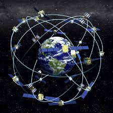
Standard GPS devices, including car GPS and your cell phone give you information about where you are in the world based on signals from a set of satellites circling far overhead. GPS is a type of GNSS (Global Navigation Satellite System). At any given moment, there may be dozens of such satellite signals that your device can use to locate where you are. And there are four different systems of satellites that provide this information, (the four global GNSS systems are: GPS (US), GLONASS (Russia), Galileo (EU), and BeiDou (China)). However those signals are affected by lots of things that can interfere. This usually means that the precision of that positioning is roughly within 1-3 meters, on average. This is great for navigating a highway, but what if you need better localization? If you’re within 10km of Swarthmore’s campus, we have just brought online a service that can allow capable GPS devices to locate position to within a centimeter! This is called NTRIP (Networked Transport of RTCM via Internet Protocol) which is a standard protocol used to stream GNSS correction data over the internet, enabling real-time, centimeter-level positioning (RTK).
Possible uses
For some tasks, knowing precisely where you are matters a lot more. For example, if you are locating where certain utilities are underground, you want to make sure you aren’t going to disturb things if you dig in an area. That 1-3 meter precision isn’t adequate. You need better. Similarly, if you are trying to map out where your drone is flying, so you can take a series of images and combine them into a precisely localized map of something. That precision can make a huge difference. If you’re building a robot to navigate the pathways of campus, 1-3 meters precision could easily see your robot failing to stay on a pathway, or running into a building, rather than going to the entrance, or your autonomous vehicle running into something just off the road.
Middle Atlantic states situation
While some states (Massachussetts, Maine, Michigan, for example) provide public NTRIP services to their citizens for free. Where we are however, the states of Pennsylvania, New Jersey, Delaware and Maryland all outsource this service to private companies that only provide the service for a rather hefty monthly fee. And they run out of licenses annually too.
Swarthmore’s solution
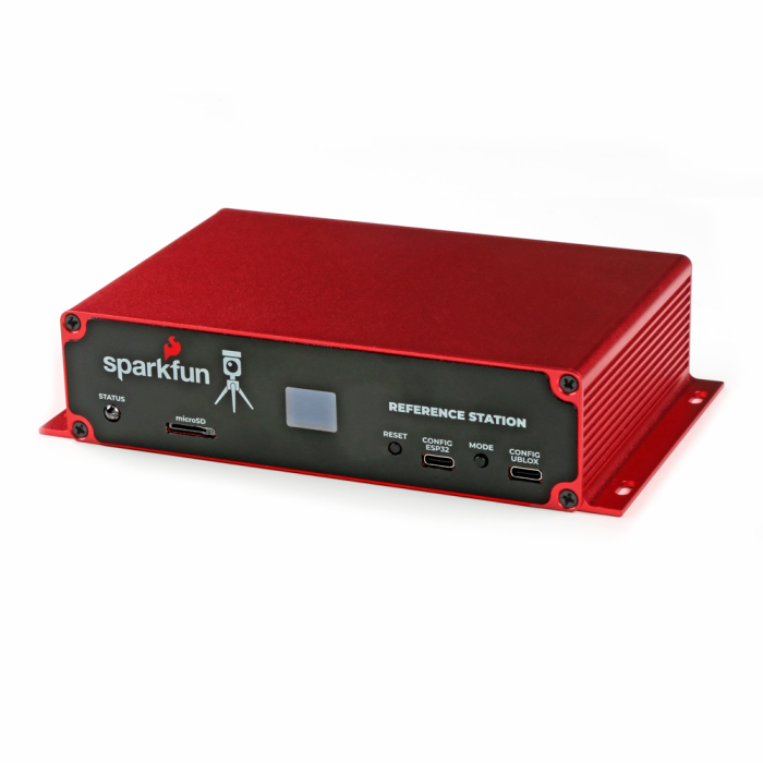
Given the interest in more precise localization from a variety of members of the community here at Swarthmore, we decided to acquire and set up a relatively low-cost solution, and to provide it to the campus community for free. We have set up a SparkFun RTK Reference Station at the top of Singer Hall. We had to have the system collect data from overhead satellites for an extended 24 hour period, then we had to have that data converted by a service. Given the paucity and expense of such resources in the US, we used a Canadian government service to process this data. Once we had the calculations back, we were able to set up an account with a publicly available service out of Hungary (on the internet, that’s next door!) to “caste” our local correction information out to users in our area that need it.
The correction data, which is constantly updated by ongoing satellite observations by our Reference Station, can be accessed by logging into this service over the internet. While we don’t intend to broadcast that login information publicly, it’s available on request from ITS for members of the Swarthmore College Community. Just put in a request at https://support.swarthmore.edu.
More information on how GPS works can be found in How GPS works: the magic of satellites and precise watches by Mihai Andrei.