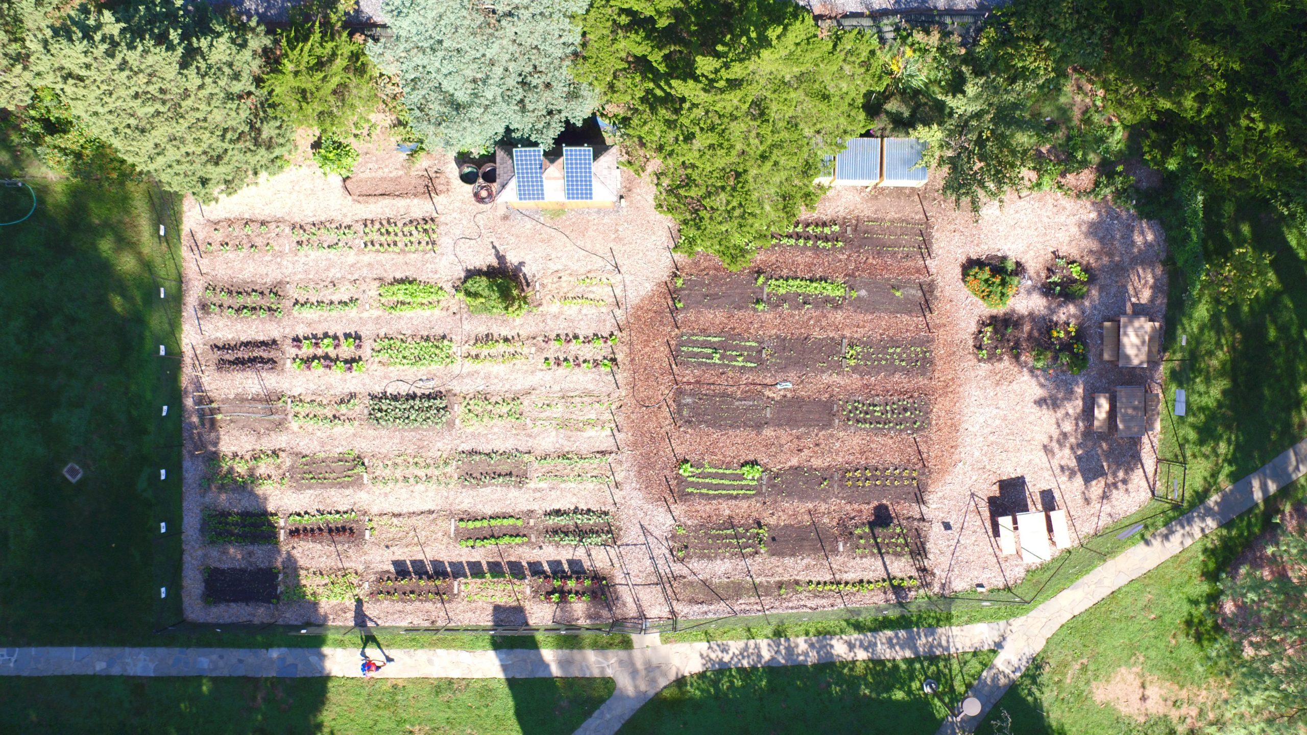
Swarthmore has a couple of drones that are being used for aerial photography and video segments about our facilities for recruiting and for research. Most recently, the Athletic department used drone footage to create a Swarthmore Athletics Drone Tour. Similarly, we have worked with members of the Biology department on videos of the Green Roof on top of LPAC, as well as gathering footage over years of the Student Gardens, next to the tennis courts. The first picture is from 2015, the second from this Fall, showing the neat rows of vegetables and greens.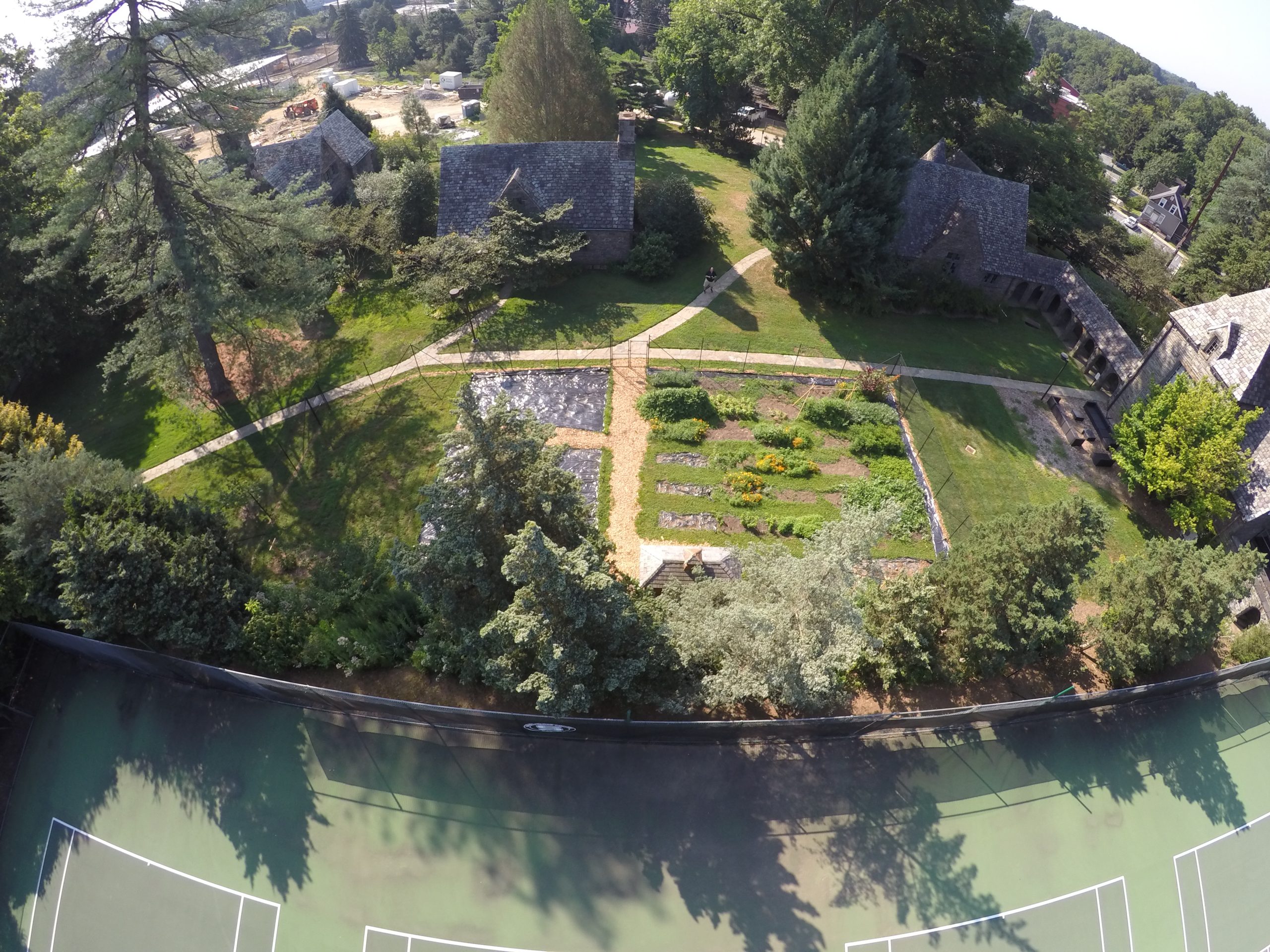
The College’s drones have been used to survey various campus building roofs for suitability for solar installations as part of a College RFP. They’ve been used to identify power boxes high up on poles, as well as to create better maps and understanding of the physical layout of campus spaces.
The College’s drones can give us different perspectives on the College that we normally see, for example this view of the Campus from 200 feet in the air, showing McCabe, some of the dorms, and Cunningham fields, looking towards the city of Philadelphia in the distance.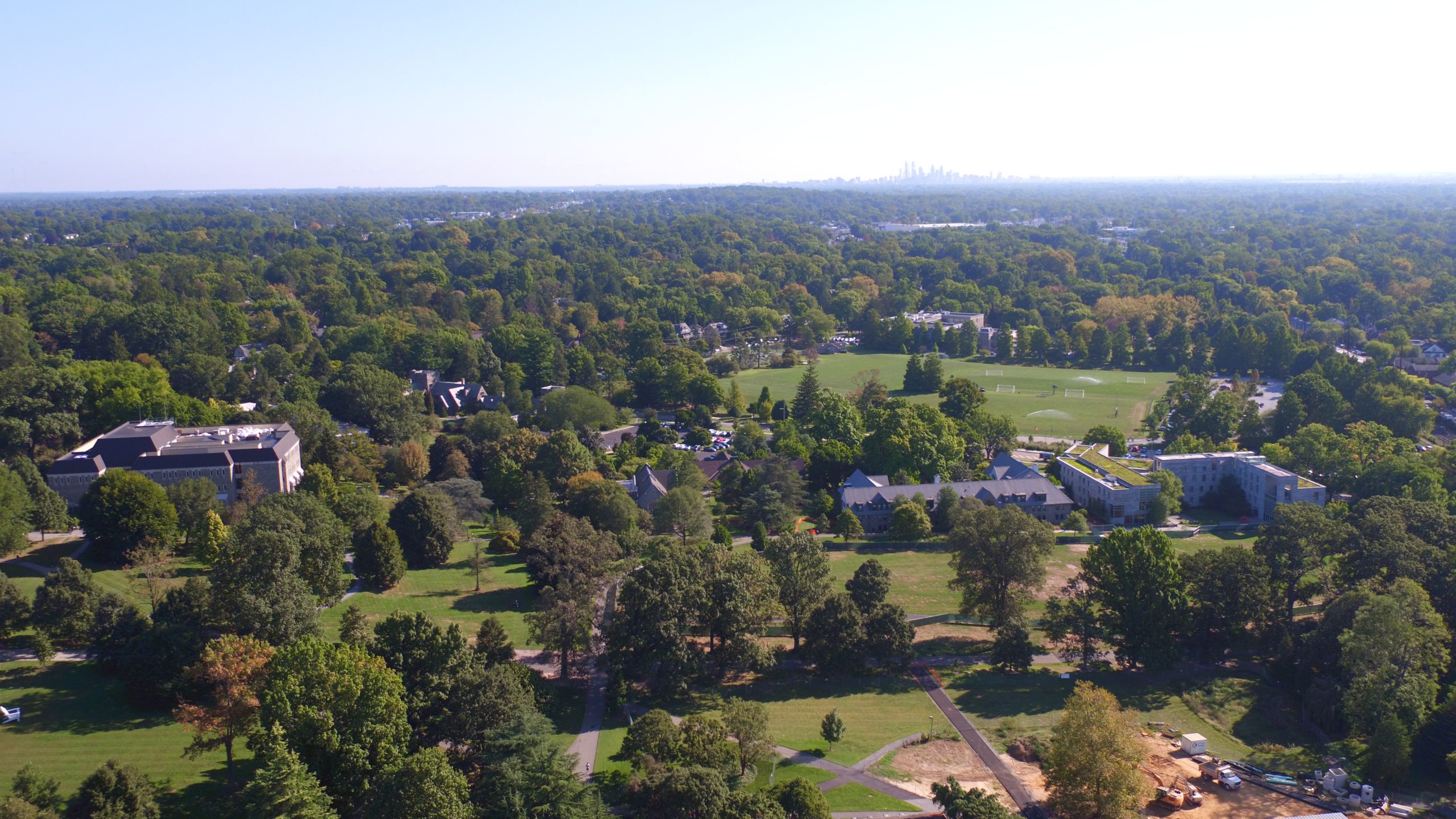
We can get views of the south parts of campus, with the vibrant garnet roofs, new track and green fields of our athletic facilities and the adjacent boroughs and townships between Swarthmore and the river. 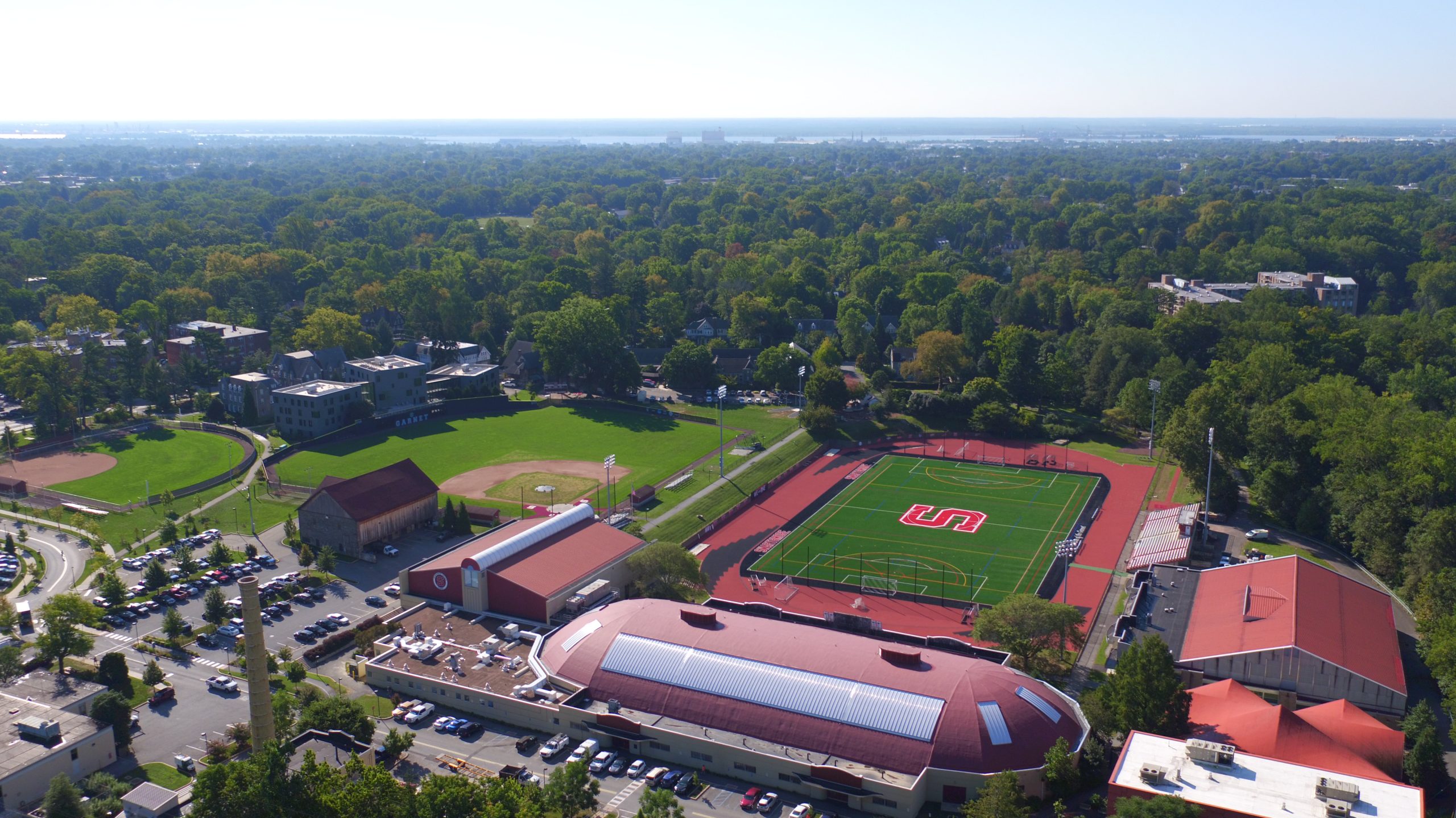
At other times, we’ve wanted a view from high above the top of the bell tower of Upper Tarble, past Sproul observatory’s dome, the dorms to the south and west sides of campus, and into the Crum Woods, where the train bridge was being reconstructed, leading into Media, from roughly 400 feet above Parrish Hall.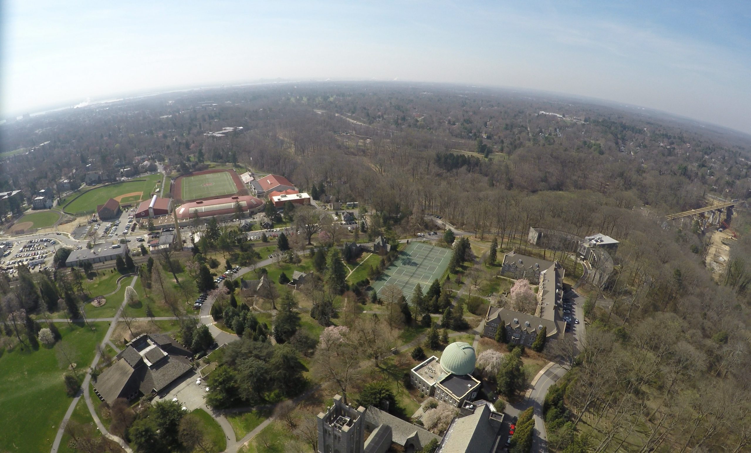
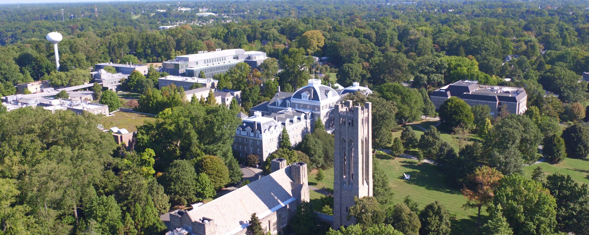
We have aerial photos of the North part of campus too, including Parrish, McCabe, the bell tower of Upper Tarble, the water tower, Science center other academic buildings and the just completed Singer Hall, towards the top of this image!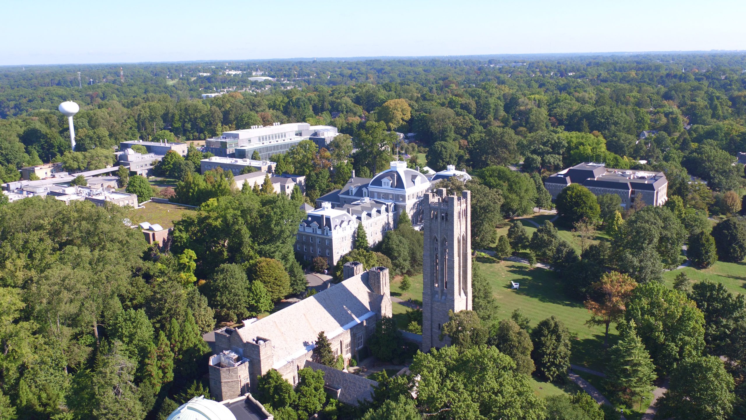
These images and videos have been taken with two current, but somewhat older drones, our older 3DR Solo, 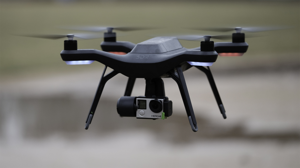 and our slightly newer DJI Inspire 1 Pro
 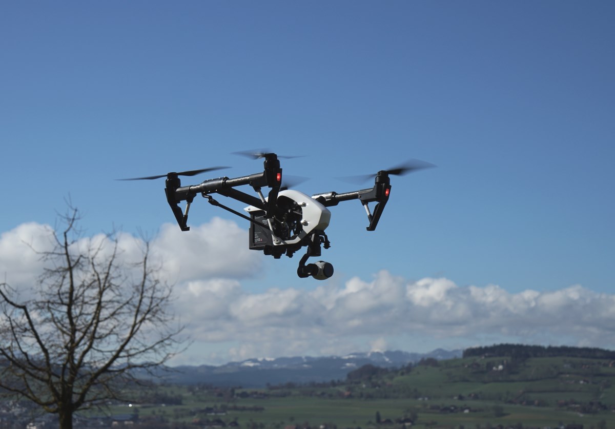 .
.
Note that the Inspire 1 Pro also has available an infra-red sensitive FLIR camera that can examine the heat output from buildings and creatures in it’s field of view. For example in this photo, you can see evidence of the rafters supporting the roof (light stripes to the left on the roof surface), and where a car was parked, well after it left, due to the cooler temps of the surface on which it had been (left edge of the driveway, just outside the garage), and the deep black (cold) spot on the top of the uninsulated chimney, showing an area of significant cooling loss.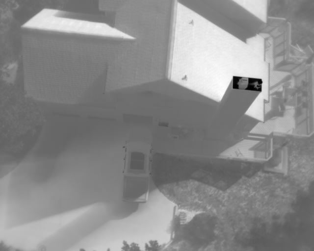
This Fall, new FAA rules will limit the utility of these two drones as neither has Remote ID built in. That requirement will be in place after this coming September. To address that, the College will acquire new drone equipment, and possibly separate modules that will add that capability to our existing drones.
The FAA is constantly updating the rules on drone flights, and Swarthmore College campus is within the controlled airspace around Philadelphia International airport, so we always need to get authorization before we fly at Swarthmore (Particularly when certain politicians go home to Wilmington!). In addition to FAA permission, potential flyers also need to work with Swarthmore campus authorities to approve their flight plans. Working together, we can fly safely, in coordination with local officials and our campus offices, and use this resource for both academic research, educational opportunities and to get great photos and videos of our phenomenal campus! Contact ITS (support@swarthmore.edu) for more information, and to engage with our team in planning flights for your project!