The College maintains two quadcopter drones that are available for faculty and staff to coordinate with ITS to use for College projects. Both are DJI Mavic 3 Enterprise quadcopters. One of them is better for straight imagery and mapping operations and the other has a thermal camera for capturing infrared imagery along with the corresponding visible light views. Both have wide-angle and zoom cameras built in. Here are some relatively recent examples of aerial imagery captured by our drones!
Departments
This department picture captures the staff of the Athletics department gathered for their field day in the center of Clothier Field Stadium.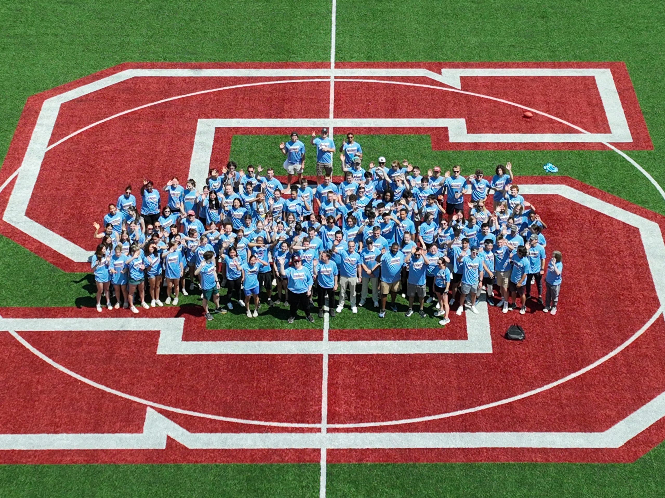
Working with the folks who maintain the athletic fields, we captured this aerial photograph of the Cunningham fields complex, taken from a few hundred feet in the air looking towards the northeast, where you can see the tennis courts just beyond the four fields of the complex.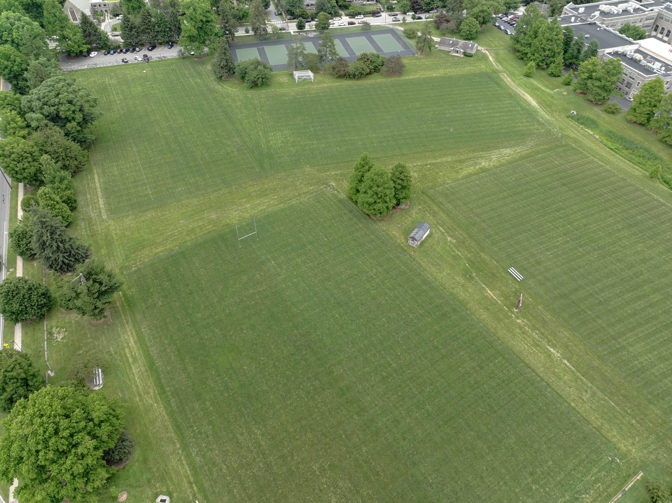
Just to the southeast of the Cunningham playing fields, there is a swale, with various plants growing and absorbing runoff. 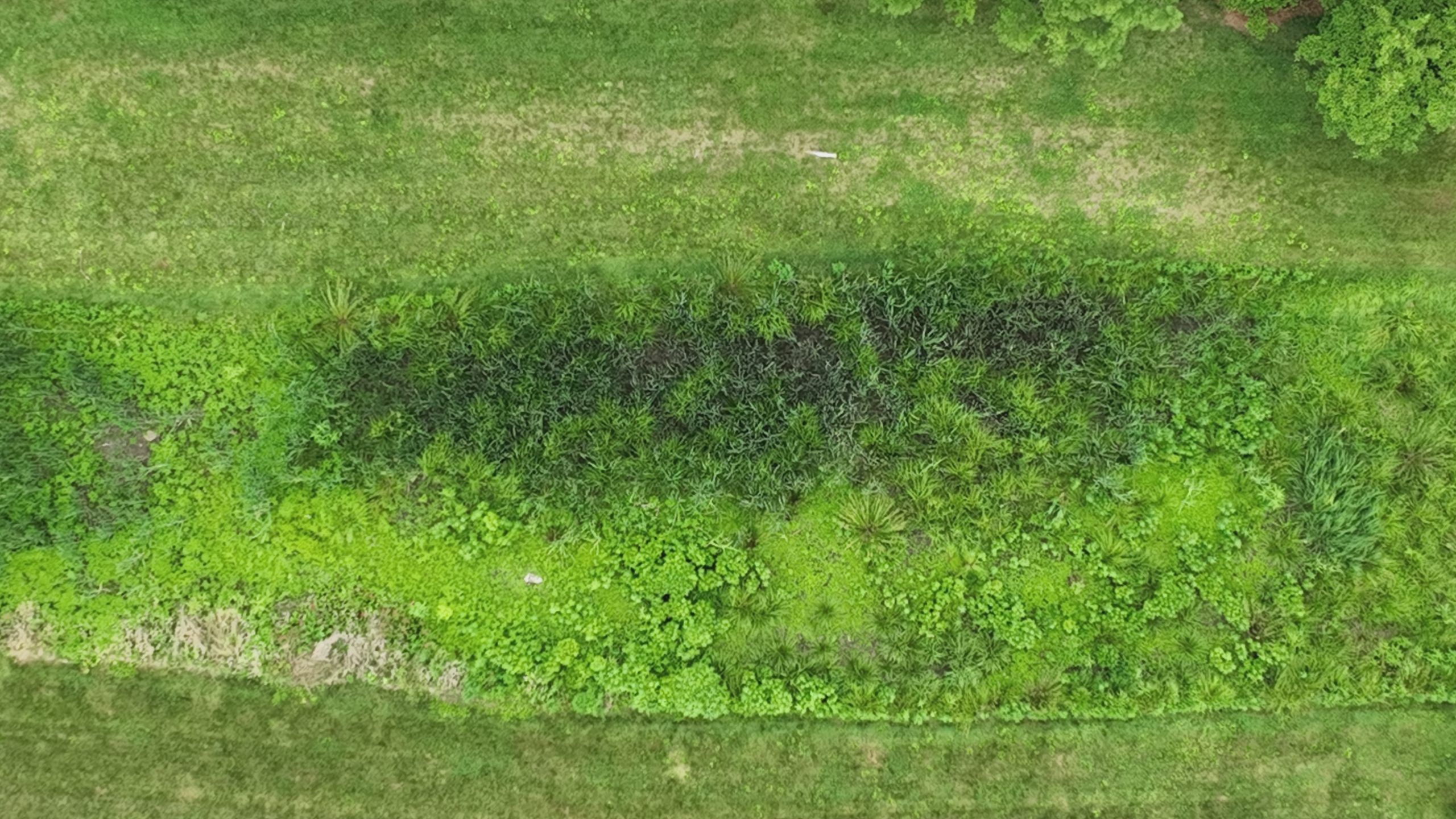
Infrastructure
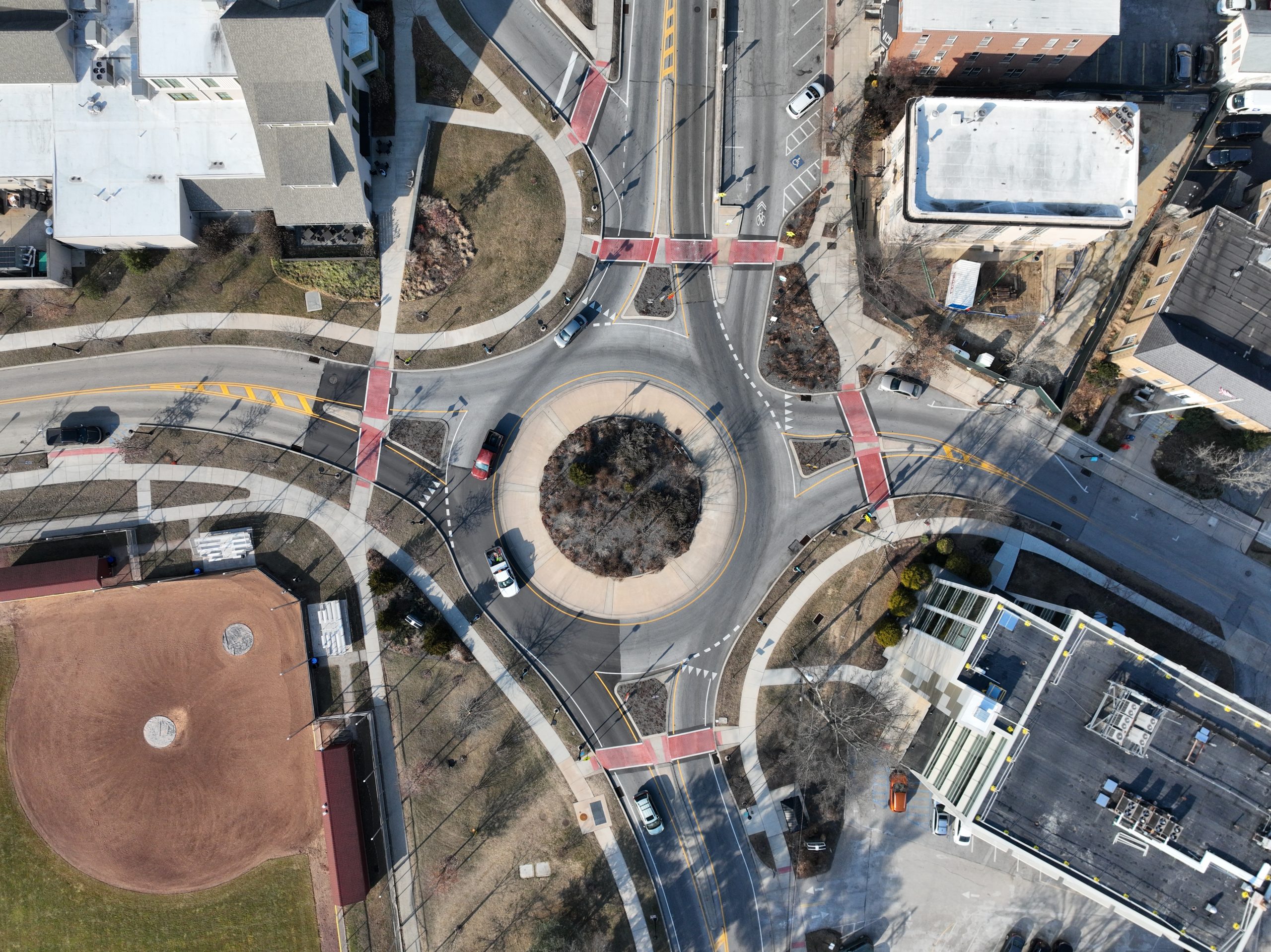
The College put a lot of resources into the relatively new, beautiful traffic circle and crosswalks that now define the southern entrance to the campus at Field House Lane and Chester Road.
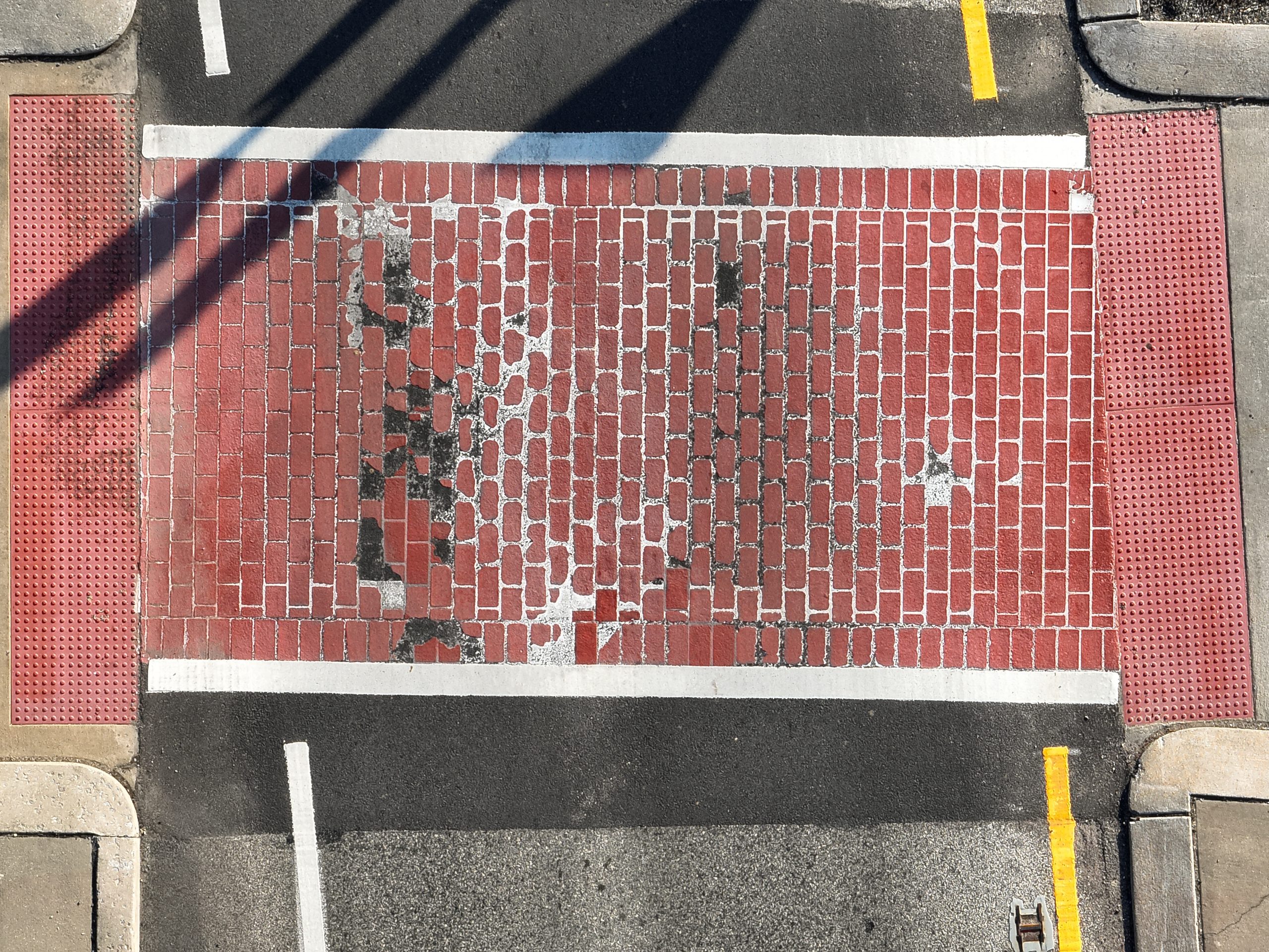
Unfortunately, some of the crosswalks have not held up as well as we had hoped.
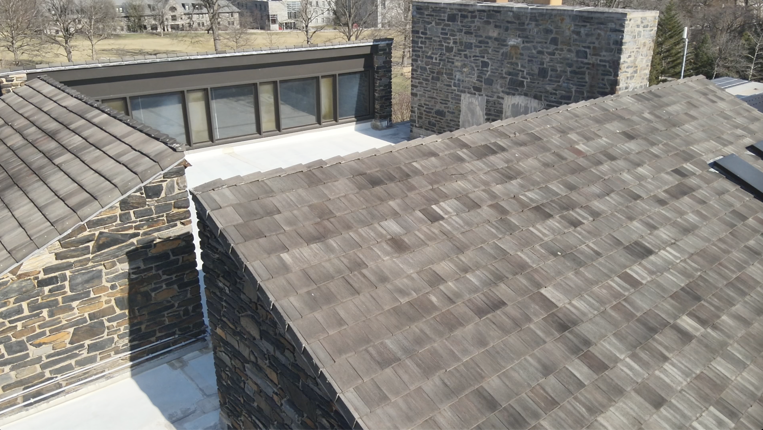
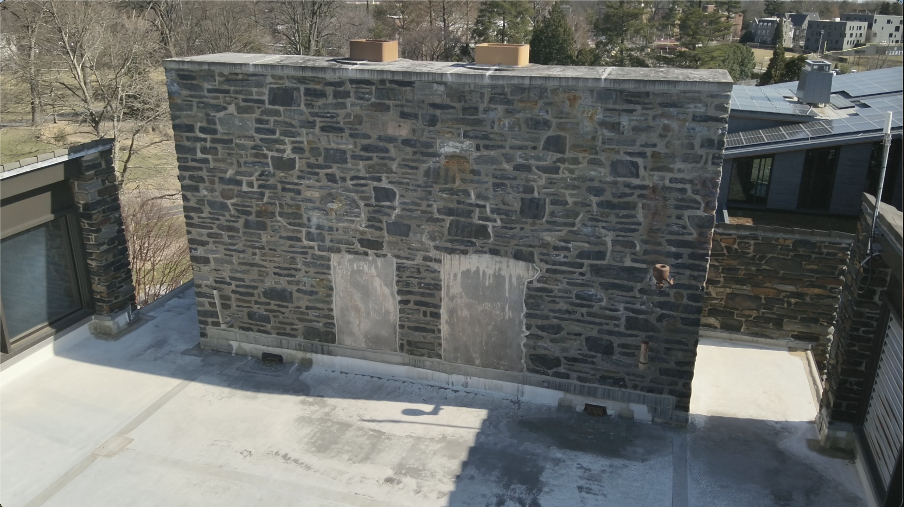
Working with Facilities, trying to track down some possible leaks in the upper levels of Sharples,here are some shots of the upper roof sections, windows and the Chimney that top that recently renovated building.
Public Safety
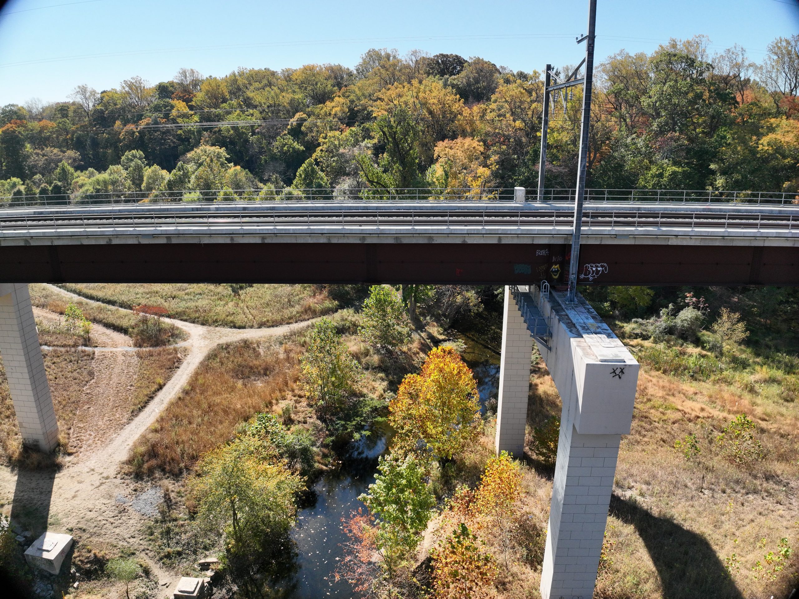
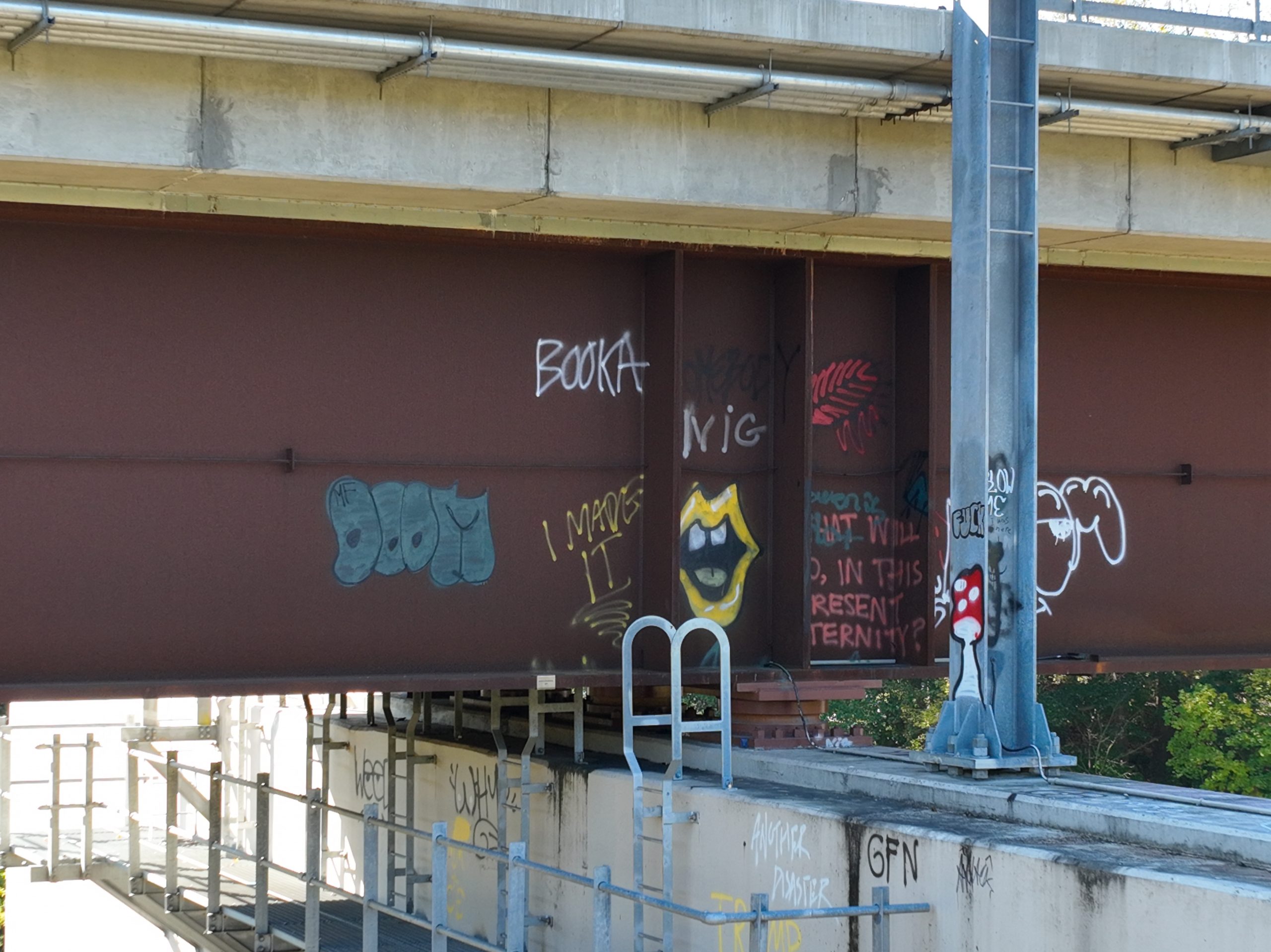
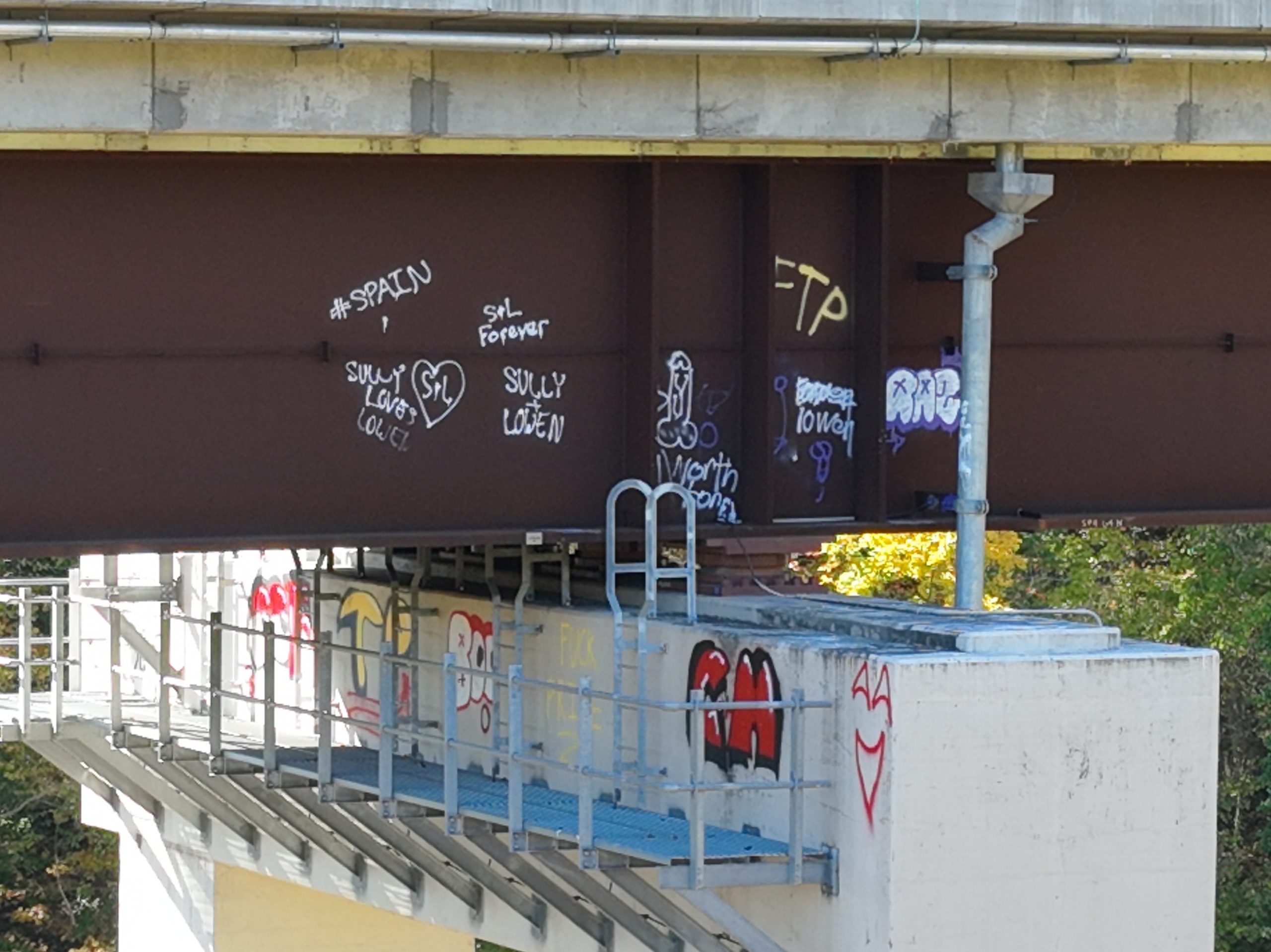
Public safety regularly has to monitor what goes on in the Crum Woods, including graffiti that might involve Swarthmore students activities on the Train trestle. Here are some images of that trestle as well as some of the markings.
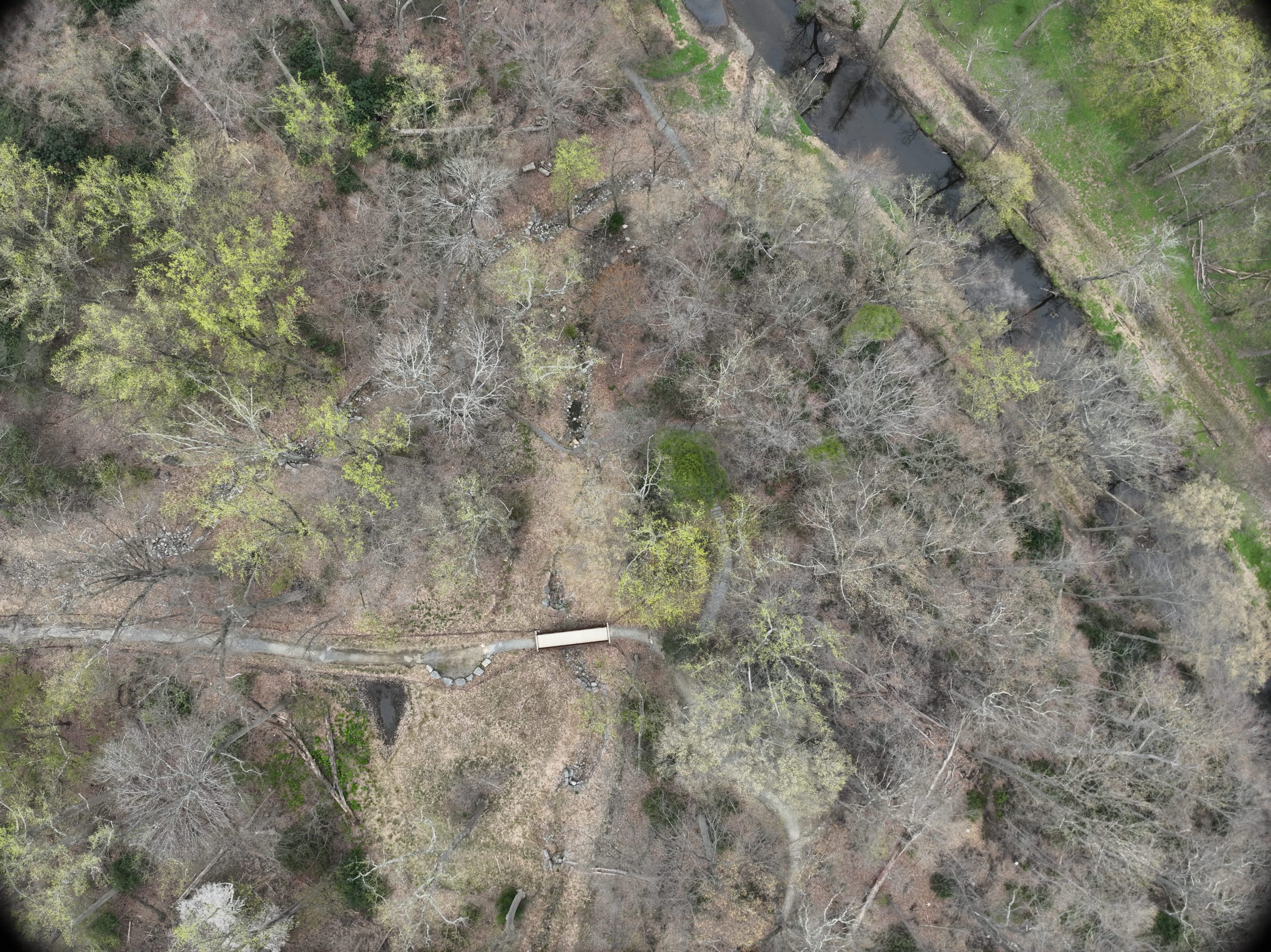
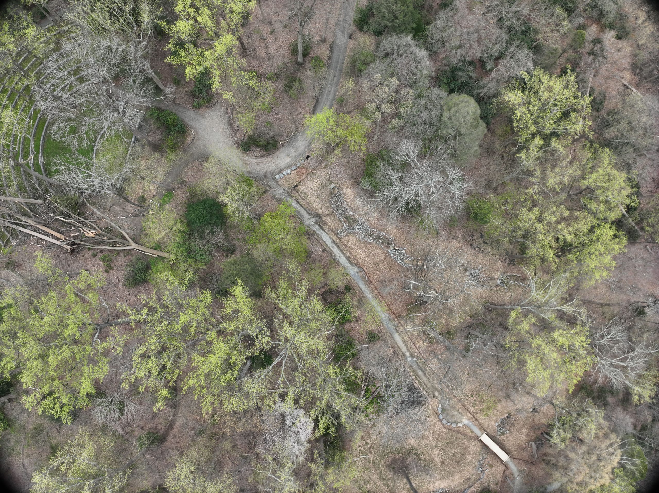
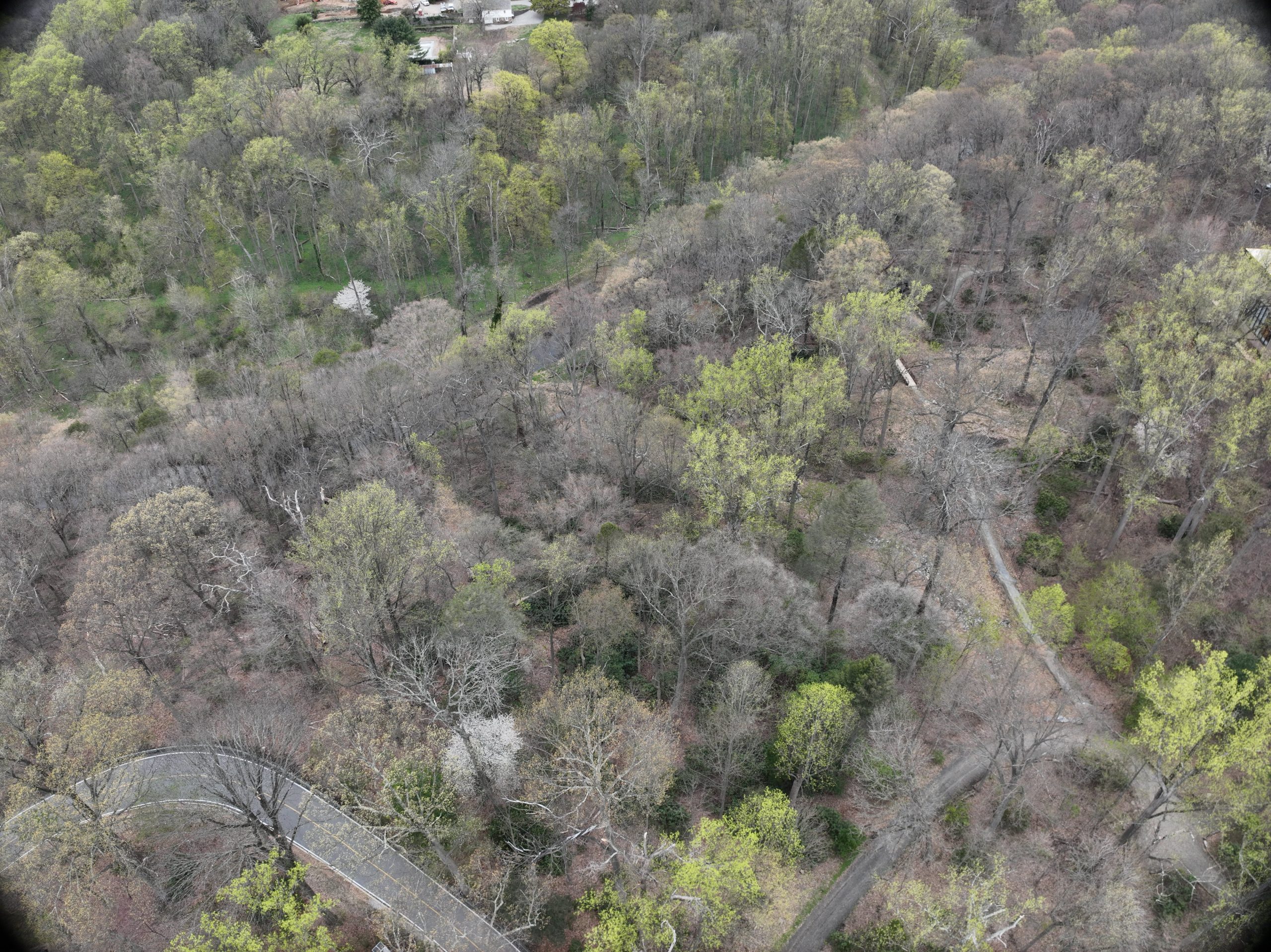
Environment
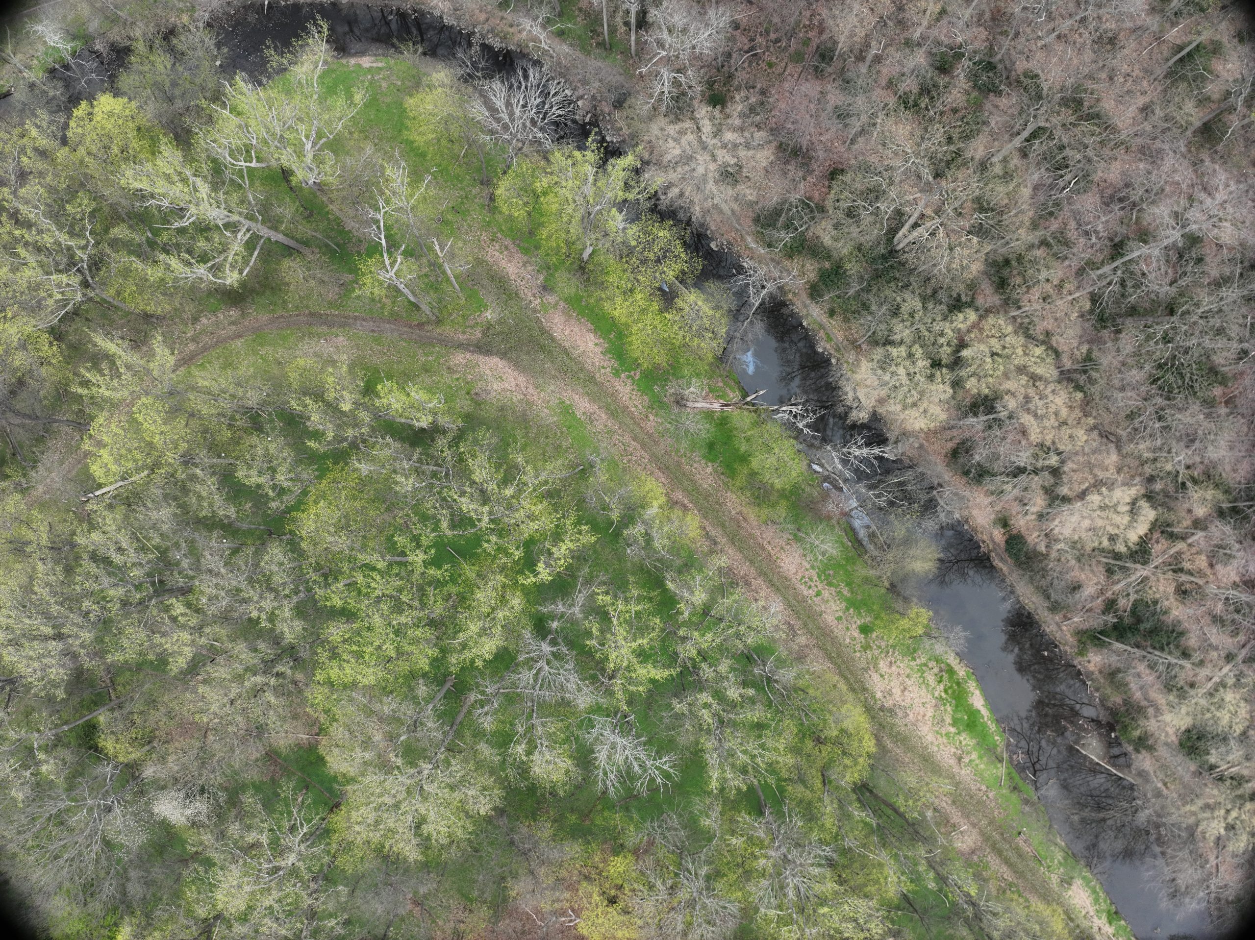
Perhaps more productively we’ve recently been able to capture some imagery of the Crum Woods from the air. In this case folks are looking at tree fall patterns. Were the recent winds that knocked down so many trees straight-line winds, or were they more tornadic in character? Looking at these aerial images of the woods (and these are just a few of the images we were able to capture) can possibly give us more insights into these recent weather events. These images are all of the northern sections of the Crum Woods north of the train trestle.
Energy Use
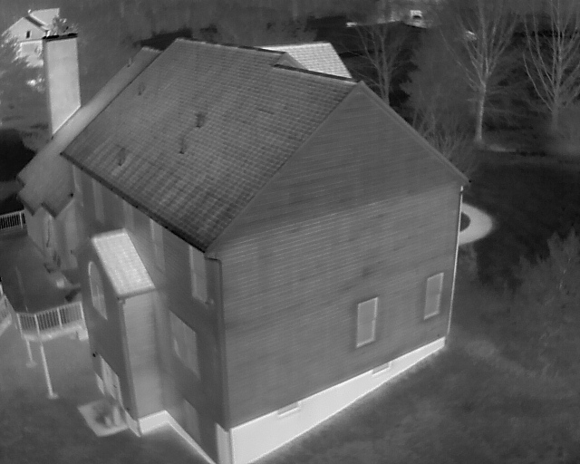
The drones can also be used for environmental insights and building energy evaluation. For example here are two images of a residential house on a cold day in January (note the snow on the ground!). In the first image, you can see a standard house end wall, and concrete basement on which it’s built.
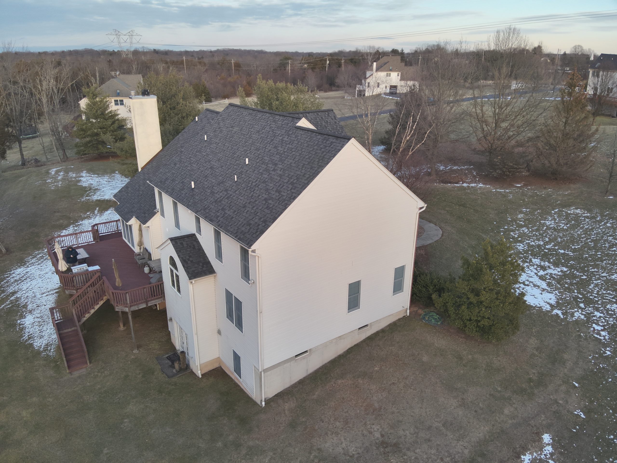
But when you see the house in the same image, taken with the infrared camera on the drone, you can see far more detail. First you might notice that you can see a difference between the two liveable floors, and a darker sidewall where the attic is. That’s because the attic is not heated! If you look carefully, you can see some of the wood framing structure through the thermal imagery too, both on the side wall, and under the roof. Possibly more interesting is that the concrete walls of the basement jump out very brightly in the thermal image. In this case, that shows that this house is loosing a lot of heat through those basement walls, where they are not underground. Likely this indicates that they are not insulated, and despite that not being a “conditioned space” it still looses a lot of heat energy from this house.
Biology
On the biological side of things, we can use the drones to see what regular human vision cannot! In this case, here is a winter photo taken of a corn field. If you zoom in a look carefully, you may be able to see a single animal roughly in the middle of the image. 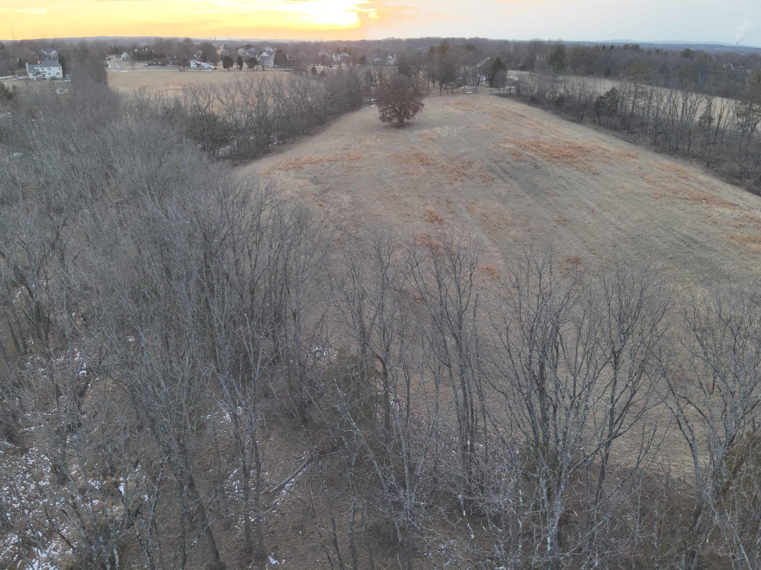
However, if you use the thermal camera and look at this shot taking simultaneously by that drone of the same field, you can clearly make out at least four animals in the image! From this distance, it’s hard to make out if they are deer, coyote’s or foxes, or something else, but they just jump out of the thermal image in ways they just don’t in the visible light image. Good camouflage for these animals! 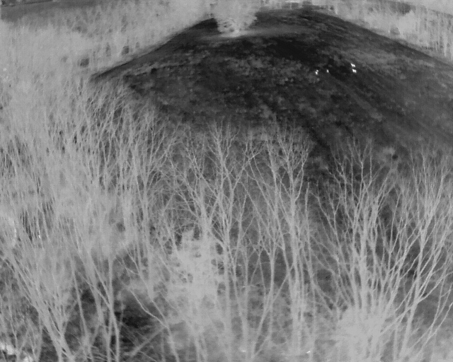
Beautiful Campus
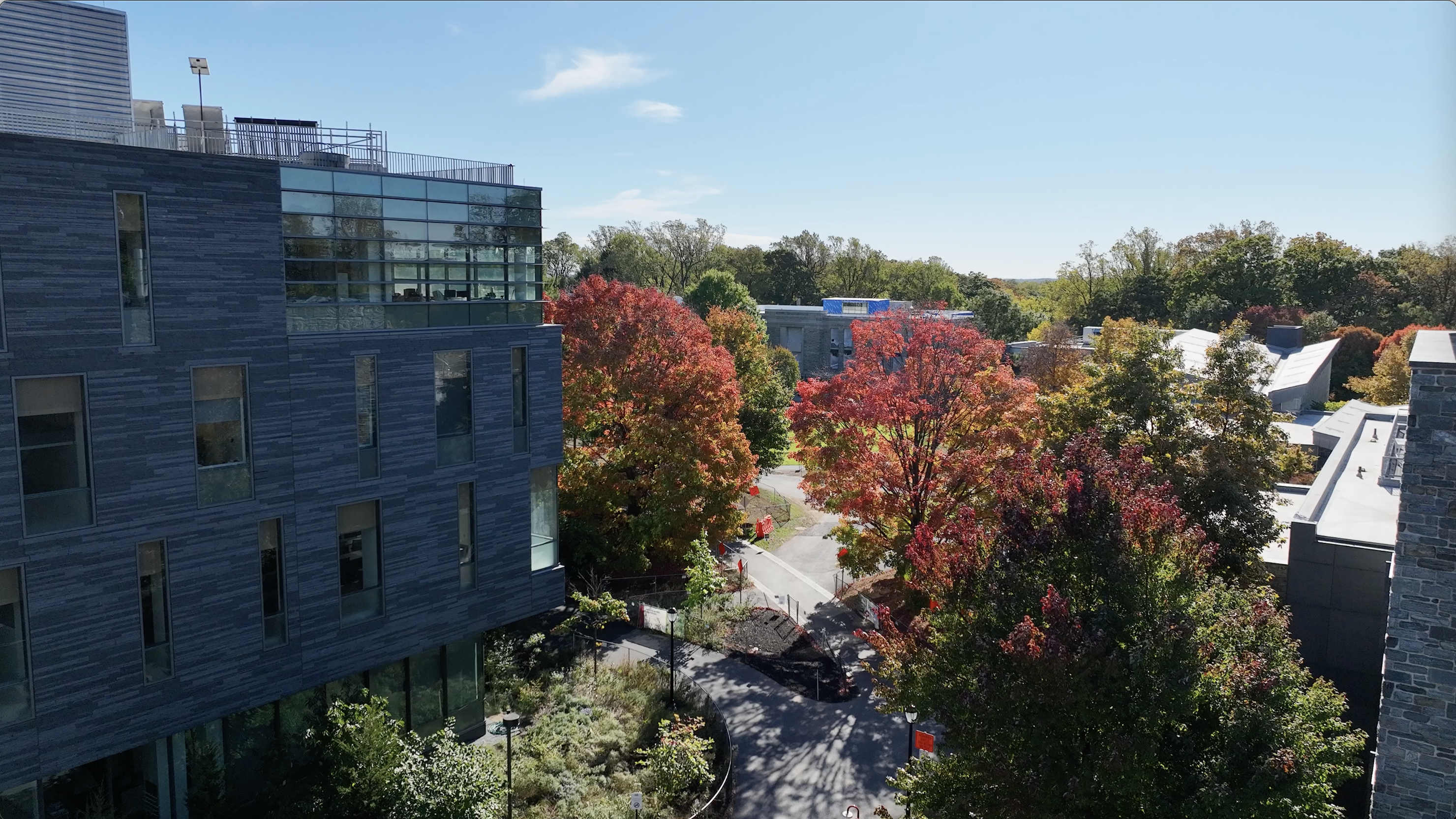
Finally, we can use the drones to take those beautiful images of our gorgeous campus that grace the web site and publications the College puts out. Here’s one of the north campus entrance with some Fall color, looking from the edge of the Whittier parking lot in towards Martin Hall.
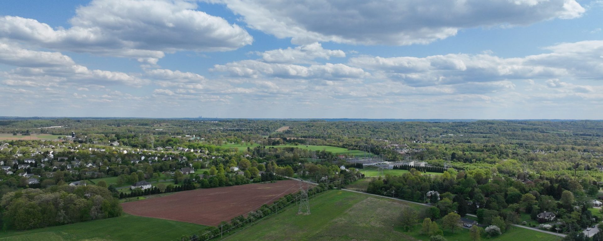
And just to be clear, the title image for this post is from about 400 feet in the air, in the geographic middle of Montgomery County (PA), looking towards Philadelphia city center. You can just make out the tallest buildings over the ridge in the distance.
These are all still images, but our drones easily capture video as well, and with a 3D camera attached, have been used to capture VR sequences as well. If drone imagery is something that you’d like to learn more about, or incorporate into you teaching or research, see our KB article and please contact ITS!
Note: Drone flights above Swarthmore College’s campus require both permission of the College (Drone flight request form) and since we are within the controlled airspace around Philadelphia International Airport, a waiver from the FAA, which means that you need to have either The Recreational UAS Safety Test (TRUST certificate) from the FAA or a Part 107 Drone Pilot’s License. You can learn more about flying a drone at Swarthmore on this KB page: Flying a Quadcopter (or other sUAS)